Prints the current language. Choose A4 and Save as PDF in your browser. Review status and references remain included; this is a teaching inspiration sheet, not a certificate.
LEARNING INSPIRATION · CTL / EDC
A Merauke Service Map: Distance and Choice
SMA · Merauke
Classroom planning proposal
Adapt with a teacher; this is not an approved grade/phase mapping.
Proposed grade/phase
Senior Grade 10; a teacher maps the activity to the school’s social-science goals.
Suggested duration
40–60 minutes for map reading, comparison and presentation.
Materials
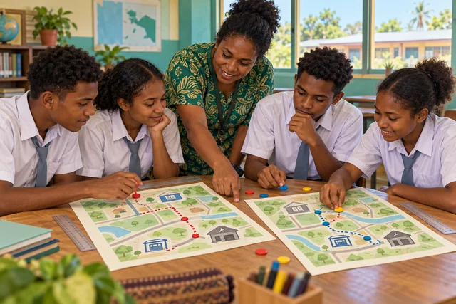
A fictional Merauke map, simulated distances/times and a legend sheet.
Learning evidence
Two location options with reasons, a legend and data limitations.
AI illustration for learning. Not a documentary photograph or a species-identification image. Confirm species details and cultural context with appropriate references and knowledge holders.
Goal — Senior secondary: examine spatial relationships, service access and social-data limits.
Experience — A teacher draws a fictional Merauke school-neighbourhood map with a library, bus stop and practice venue. Label all distances and routes as simulations, not travel directions.
Deconstruct — Is the shortest route always the most accessible? Compare distance, simulated time and user needs. Separate group assumptions from observed evidence.
Create — Propose two locations for learning activities and explain who benefits or remains disadvantaged. Add a map legend and list information needing verification before real planning.
Learning evidence — Assess map reading, decision reasons and conclusion limits. A teacher places the activity within the appropriate social-science discipline for the school structure; one example does not cover all senior secondary social-science goals.
Related learning ideas
Selected from published articles by shared subject, level or context; review status may differ.